Let’s Start Work
Together
Please feel free to contact us. We will get back to you with 1-2 business days. Or just call us now.
186 Port Said St, Sporting Alexandria - Egypt
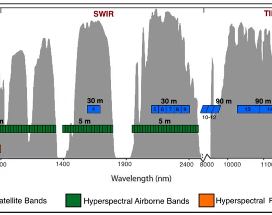
Remote Sensing & Geophysical Surveying
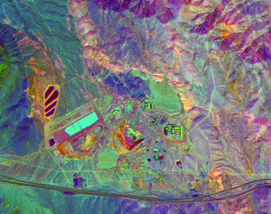
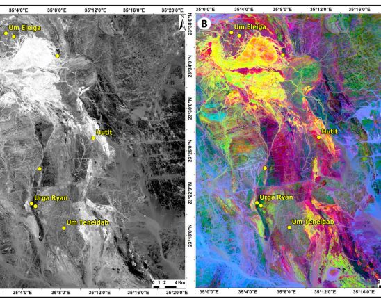
We interpret remotely sensed data using a sound structural geological understanding to provide informed, integrated interpretations that can be directly applied to exploration targeting.
Also, ARCHEAN offer a full in-house solution for various geophysical survey for various exploration programmes, from conception and planning to interpretation and presentation. Aurum will be able to design and advise on suitable surveys for many styles of mineral systems.
We are able to assimilates complex data sets to generate and refine targets, define controls on mineralisation, and delineate prospective structures and sequences. Integrating the data with our geological and structural knowledge enables us to identify geological processes, detect structures, and assess the likelihood of ore deposit accumulation.
Remote Sensing Services include:
- Interpretation of aeromagnetic and satellite imagery data to produce structural and geological maps that help target deposits
- Ranking of exploration targets for specific deposit styles
- Interpretation of 2D and 3D seismic data and integration with aeromagnetic interpretations to produce 3D models of basement architecture
- Production of interactive GIS maps and models that clients can update over time
Geophysical services include:
- Gravity
- Ground Magnetics
- Induced Polarization (IP)
- Ground electromagnetics (EM)
- Ground MT (MT)
- Magnetic Susceptibility